Rewild
Nature
One Small Space
at a Time
Mother Tree Hub
feature
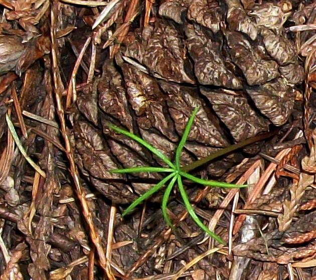
As you improve your skills at picking up feelings from plants and trees you will discover that plant energies within ecosystems gather into energy guilds. Often these guilds are strongest around Mother Trees. Like all plants, trees provide energy emissions, which also carry communication between themselves and others.
We really have a lot to learn about how everything works – and how everything is connected. Join us for a presentation about the importance of Mother Trees.
Library 2 – Ecosystems, Watersheds
and Species at Risk
How ecosystems work. Understanding environmental mapping, wetlands, forests and mountains.
The whole Southern Interior is the territory of Okanagan, Nlaka’pamux, Secwepemc, St’at’imc and Kalispell First Nations. It is in the rainshadow of the Coast Mountains in B.C. and the Cascade Mountains in Washington. It is warm and dry in the summer and can get very cold in the winter, but only the mountains and highlands get a lot of snow.
The landscape has dry grasslands, forests, deep river valleys and large lakes. Ponderosa pine and Douglas fir forests cover much of the area, providing homes for several rare types of bats and other mammals. In other parts, rocky hills, cliffs and even a desert are home to species only found in this ecoprovince. A proposed pipeline carrying diluted bitumen from Alberta would run through the Southern Interior ecoprovince disturbing fragile grassland ecosytems and endangering the waterways of the region.
The major cities are Kamloops, Vernon, Kelowna and Penticton.
Species at Risk in British Columbia
Red, Blue & Yellow Lists
Based on their conservation status rank, each species and ecosystem is assigned to the red, blue or yellow list to help set conservation priorities and provide a simplified view of the status of B.C.'s species and ecosystems. These lists also help to identify species and ecosystems that can be considered for designation as "Endangered" or "Threatened."
New Species at Risk Site
Species at Risk Explorer
The Shuswap Watershed
WETLANDS
Don Gayton Wetlands Workshop
Ecologist Don Gayton, wetlands coordinator for the Okanagan Basin Water Board, describes the Okanagan Wetlands from a historical perspective. His specialties include: grassland vegetation monitoring, fire ecology, ecosystem restoration & science extension.
The Okanagan Wetlands Strategy is a three-phase effort to re-establish wetland ecosystems. Wetlands are areas that hold water either temporarily or permanently. Some types of wetlands are sloughs, ponds, marshes, swamps and bogs. They are rare habitats in the dry Okanagan but they are home to diverse plants and animals and are an important source for food, freshwater, flood protection and erosion control. Unfortunately, wetlands have been lost or impacted by urban development, agriculture, forestry, encroachment of invasive species and climate change. Wetlands represent about 0.2% of the regional landscape, but it is estimated that 84% of low elevation wetlands in the Okanagan and lower Similkameen valleys were lost between 1800 and 2003. A second study of low elevation wetlands in the Okanagan Basin indicates a 38% loss of wetlands between 1988 and 2010.
For the purposes of this guidebook, Constructed wetlands (CW) are defined as water treatment systems that use natural processes involving wetland vegetation, soils, and their microbial assemblages to improve water quality (US EPA 2017). A CW typically differs from a conventional stormwater pond in that wetland plants are specifically included in the design so that at least 25% of the area is vegetated by cattails, bulrushes, or other aquatic plants. These water treatment systems can also be called treatment wetlands, for simplicity in this guidebook we use the term CW.
Sensitive Habitat Inventory and Mapping and Wetland Inventory Mapping for the City of Salmon Arm
The first phase of sensitive habitat inventory and mapping (SHIM) and wetland inventory mapping (WIM) project was completed in the City of Salmon Arm by Forsite Consultants and Avocet Environmental Consultants. The inventory work assessed 69 kilometres of stream and 71 wetlands within the study area. Eight stream corridors were part of the inventory area and included Canoe, Palmer, Leonard, Hobson, Syphon, Cress and Turner Creeks and the Salmon River. Objectives of the inventory were to provide accurate spatial layers on the extent of streams and wetlands, and associated fish and riparian habitat features that could be incorporated into the city’s GIS management environment to support land-use management decisions and habitat enhancement opportunities.
British Columbia Community Mapping Network
https://cmnbc.ca/atlasgallery/bc-wetlands-atlas/
The BC Wetlands Atlas provides a citizen-science based approach to mapping wetlands in British Columbia and is an initiative of the BC Wildlife Federation’s Wetlands Education Program. The Atlas includes the provincial wetland layers (TRIM), some regional wetland mapping and it allows you, as a steward, to participate in conservation by adding valuable information to known wetlands and/or incorporate wetlands currently not found in the public domain.
The Okanagan Habitat Atlas is a web-based mapping tool that brings together a variety of information about natural and cultural attributes and resources of the Okanagan Basin. Its main purpose is to build capacity within and between Okanagan communities by facilitating access to local resource inventory that can be used for local land-use planning and stewardship efforts. The contents of the atlas can assist people in creating a profile of the myriad of ecosystems with which they interact in the Okanagan (from the macro to the regional), be used in the development of communications and interpretive products and provide the building blocks for rural and urban planning. To view the Okanagan Habitat Atlas click here:
Conserving Okanagan Wetlands:
Local Government and Provincial Tools
Wetlands are one of the most impacted and important ecosystems in the Okanagan. This workshop brought together over 50 local government planning staff and environmental professionals, who are key to wetland protection, and have a unique perspective and opportunity to take action to make a difference. This report outlines the key actions identified for enhancing wetland protection, highlighted in blue throughout this summary, as recorded by note-takers at the workshop.
The B.C. Wildlife Federation’s Wetlands Workforce project is one of the largest projects funded through the Healthy Watersheds Initiative. As the largest collaborative wetland initiative of its kind in Canada, the Wetlands Workforce project aimed to bring increased knowledge and understanding of the condition of B.C.’s wetlands to community, regional and provincial levels. On March 4, 2022, the Wetlands Workforce Headquarters team presented on the many achievements that came out of this one-year project. The full presentation can be viewed below.
The Columbia Wetlands stretches between Canal Flats and Golden, BC, peacefully meandering alongside the Upper Columbia River. To the east are the Canadian Rockies. To the west is the Purcell Mountain Range.
A Mini Documentary: Wetlands Conservation through Private Land Stewardship in the Kootenays
MOUNTAINS
Mountains and alpine ecosystems can be explored by reviewing provincial park management plans for parks that have a range of alpine and subalpine areas.
Monashee Provincial Park
The management plan for Monashee Park focuses attention on the significant role this park has in protecting wildlife species and habitat, and providing unparalleled recreational opportunities in the Monashee range.
Graystokes Provincial Park
Granby Provincial Park
The Mother Tree Hub assists individuals with their efforts to dwell closer to nature and to develop enterprise that both rewilds nature and delivers ongoing regenerative stewardship.
The incubator interacts with the Wildcraft Forest School and Extension Services and contains both a residency program and an online program. Both programs seek to develop leadership within individuals and encourages small footprint lifestyle options while creating forms of social enterprise that links nature with agriculture, medicine and services which support a living Sanctuary Forest.
I
f you believe that you might benefit from the Mother Tree Hub and you are willing to expand your relationship with nature please contact us and we will set up a live conference call with you.
Contact our office by email at the Sanctuary Forest Network: services(at)sanctuaryforestnetwork.com
Or you can call the Wildcraft Forest on our direct line at:
250.547.2001
THE MOTHER TREE HUB - LIBRARY2
The Mother Tree Hub
An information portal produced by the Wildcraft Forest Foundation with support from the Regional District of the North Okanagan Conservation Fund; the David Suzuki Foundation and other community supporters.
The Wildcraft Forest Foundation offers skills, insights and
inspiration for creating good stewardship and positive change.
Located at the Wildcraft Forest
1981 Highway 6 Lumby, British Columbia
Discovery Centre – 250.547.2001 Email: services@sanctuaryforestnetwork.com
Main Website: www.wildcraftforest.com
Extension Services: www.wildcraftforestschool.com
Resource Centre: www.mothertreehub.com
This website and all material is copyrighted by the Wildcraft Forest Foundation
www.mothertreehub.com